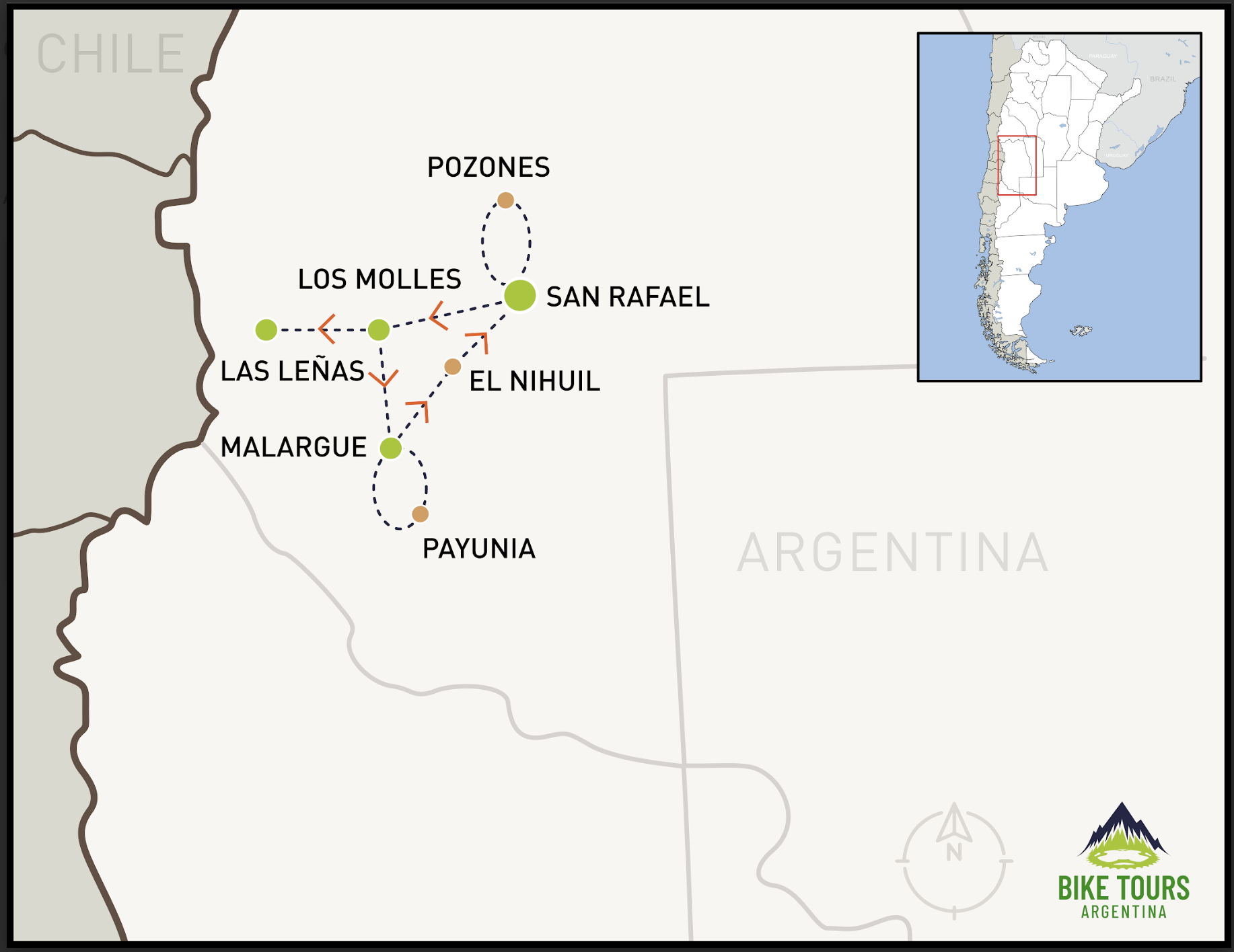
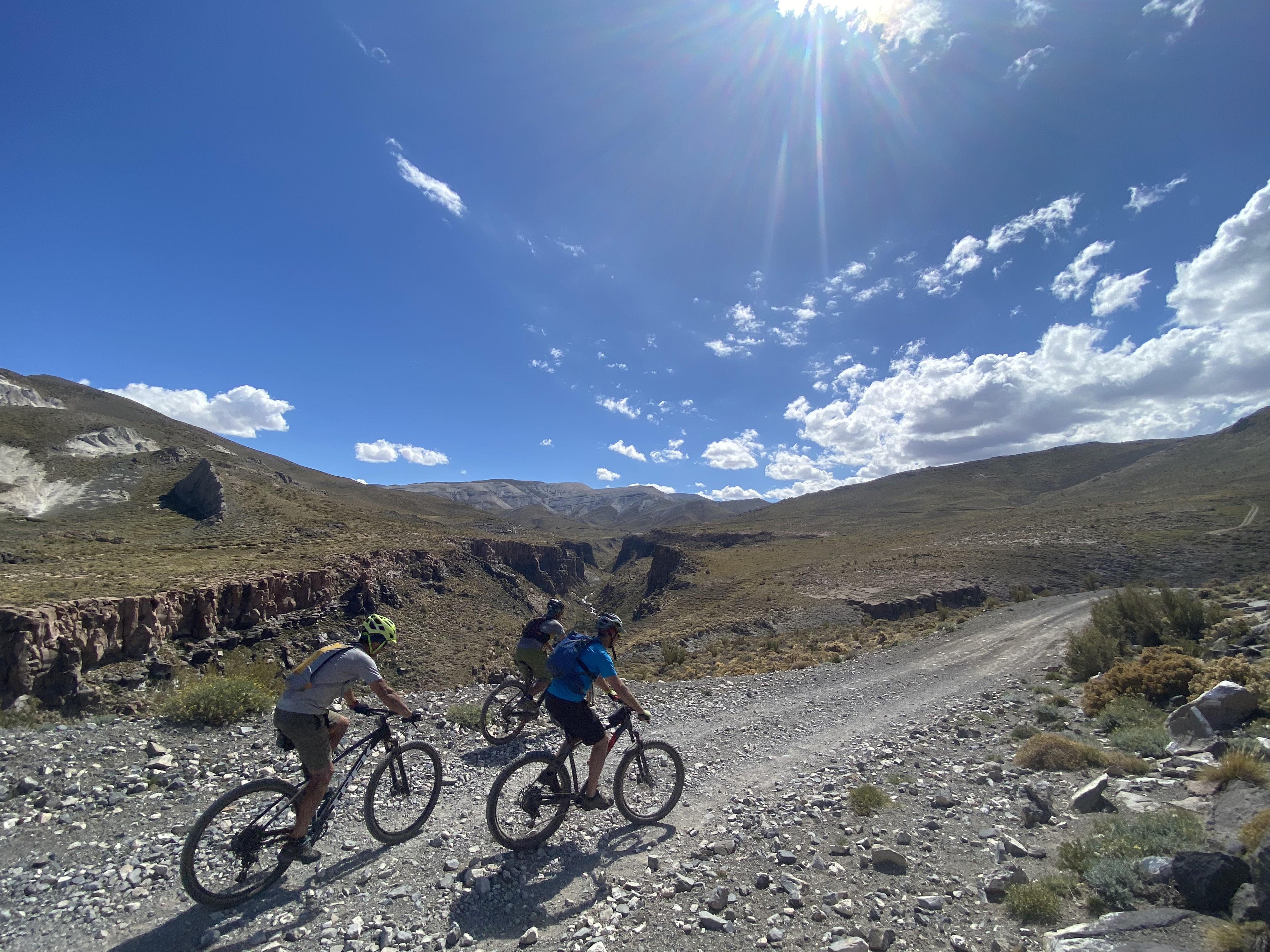
The southern part of the Cuyo region is spectacular for cycling, with wide valleys that hide small spots for those who know where to look. Looking ahead each day, you'll be met with stunning views of the Andes mountain range
The Highlights
- Cycle through the land of volcanoes in La Payunia.
- Visit the Las Leñas Valley in summer to see the lush green landscape of this ski resort.
- Ride a bike along almost the entire Atuel River route, from the mountains to the plains, passing through the famous canyon.
Itinerary
Day Before
Meeting in San Rafael.
Meet your guide and go for a warm-up ride to test the bikes that will be used during the journey and finalize the last details of the adventure.
Day 1 | Los Pozones
To warm up, we will head west to Sierra Pintada, a mountain range with incredible colors. The goal is to visit the hidden pozones (natural pools) in a small secluded area before returning to San Rafael.
Day 2 | Laguna Blanca – Los Molles via Escorial
Transfer: 140 km
Today the route takes us "into" the mountains, starting from the foothills area, visiting Laguna Blanca, and then entering the Salado River valley. On the way to Los Molles, where we will spend the night, we will pass by ancient lava escorials and the Laguna de la Niña Encantada (Enchanted Girl Lagoon).
Day 3 | Los Molles – Las Leñas – Malargüe
The plan for today is to continue ascending through the valley to visit the famous Las Leñas ski resort in its summer version. In the afternoon, we’ll have a full descent down the valley, passing by the Pozo de las Ánimas and ending at the junction with Route 40.
Transfer to Malargüe: 30 km
Day 4 | Payunia
Today we will ride through a natural reserve of 665,682 hectares. It is an area of great volcanic diversity, with over 800 volcanoes and vast lava fields. The reserve is home to rich wildlife and flora, including guanacos, foxes, birds, and various plant species.
Day 5 | El Nihuil
Transfer: 160 km
The plan is to descend the entire Atuel River route, passing through four reservoirs and areas of the valley known for their vibrant colors and unique, beautiful rock formations. The final stretch will be on pavement through the Atuel Valley, where most of the rapids are located and the river reaches its strongest flow.
Transfer from the end of the canyon to San Rafael: 22 km
trip summary
| Distance | Slope | Pavement | Gravel | Lodging | |
| Previous Day | Group Welcome | Hotel | |||
| Day 1 | 65 km | 780 mts | 20 km | 45 km | Hotel |
| Day 2 | 58 km | 1100 mts | 0 km | 58 km | Hotel |
| Day 3 | 70 km | 560 mts | 70 km | 0 km | Hotel |
| Day 4 | 55 km | 900 mts | 0 km | 55 km | Hotel |
| Day 5 | 62 km | 570 mts | 47 km | 15 km | Hotel |